Skardu District is a locale of Pakistan directed area of Gilgit–Baltistan. It is restricted on the southeast by Kargil area in the Jammu and Kashmir, on the east by Kharmang District, on the upper east by Ghanche region, on the south by Baramulla and Kargil District, on the west by region Astore and the north by Shigar District. Skardu town is the capital of the locale and the Skardu District. The most noteworthy top in Skardu District is K2 (8,611 m), which is the most critical top in Pakistan and the second most essential top on earth. The Baltoro Muztagh (the subrange of Karakoram that fuses the convincing zeniths of K2 (8,611 m), Broad Peak (8,047m), Gasherbrum (8,000+ m) and Masherbrum (7,821 m) lie in the Skardu District. Askole is the last settlement in the area for all treks to Concordia (the intersection of Baltoro Glacier and Godwin-Austen Glacier). The Biafo Glacier and a significant piece of Hispar Glacier are additionally incorporated into the Skardu District.
Gilgit Baltistan:
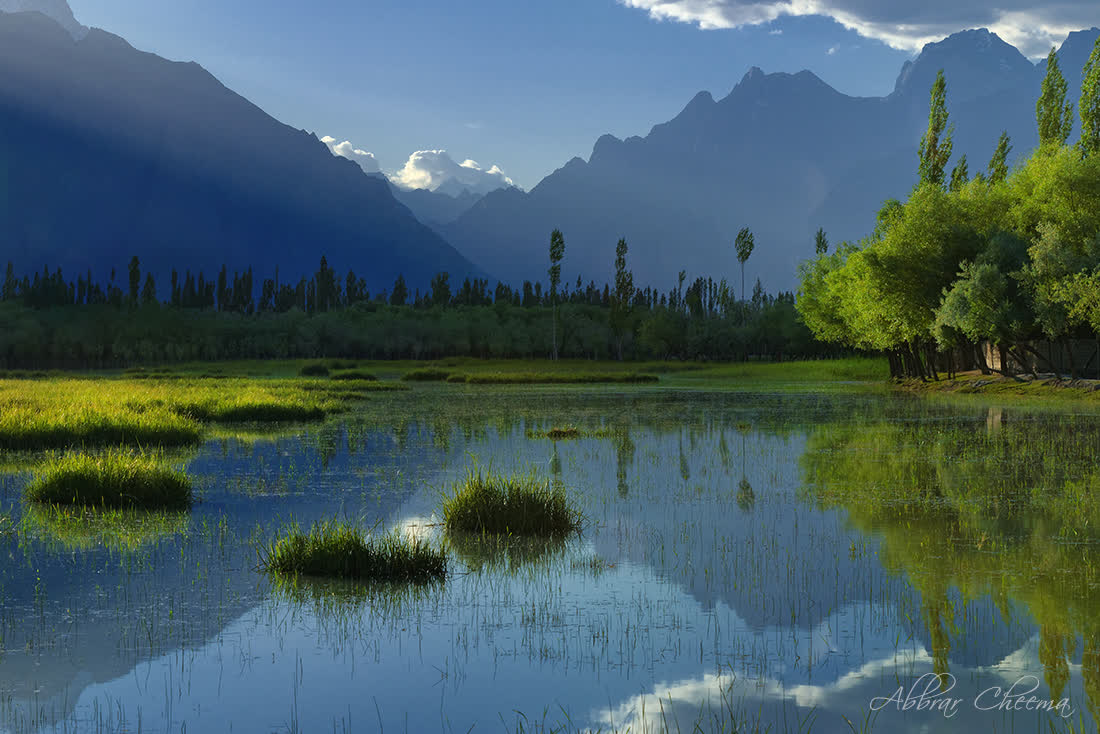
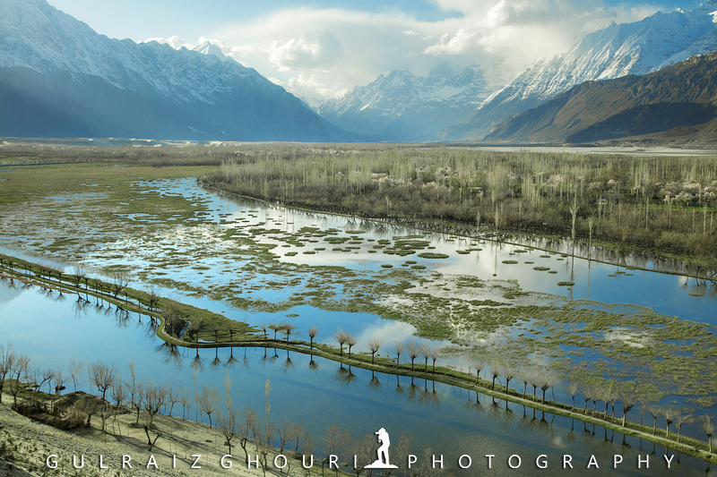
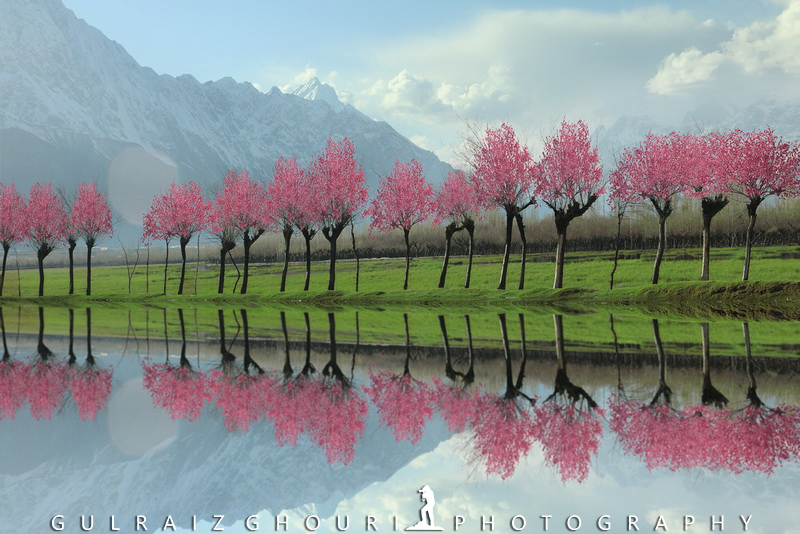
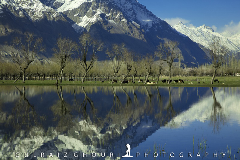
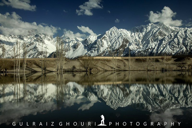
There's a great deal to do in Gilgit Baltistan. Regardless of which season you visit, you will discover new opportunities to appreciate all the beautiful things Gilgit has to offer.
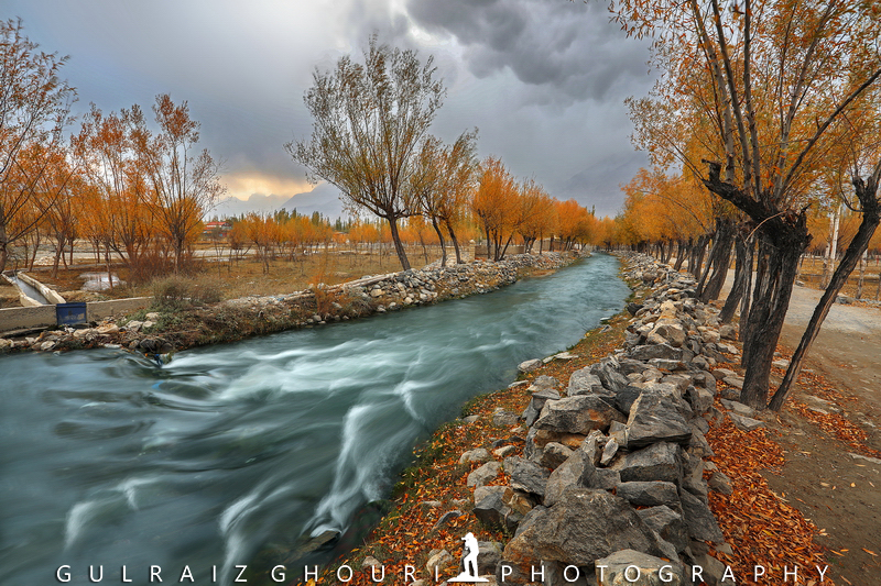
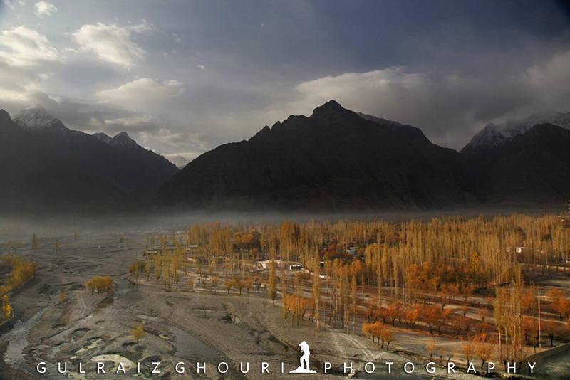
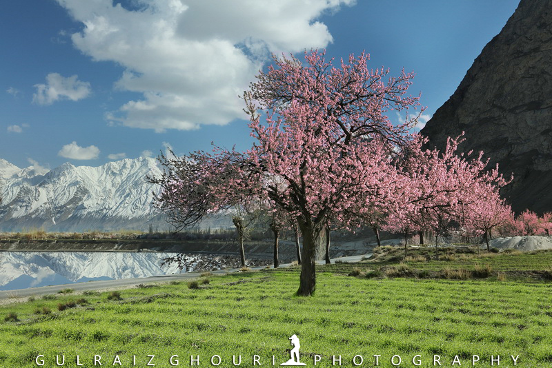
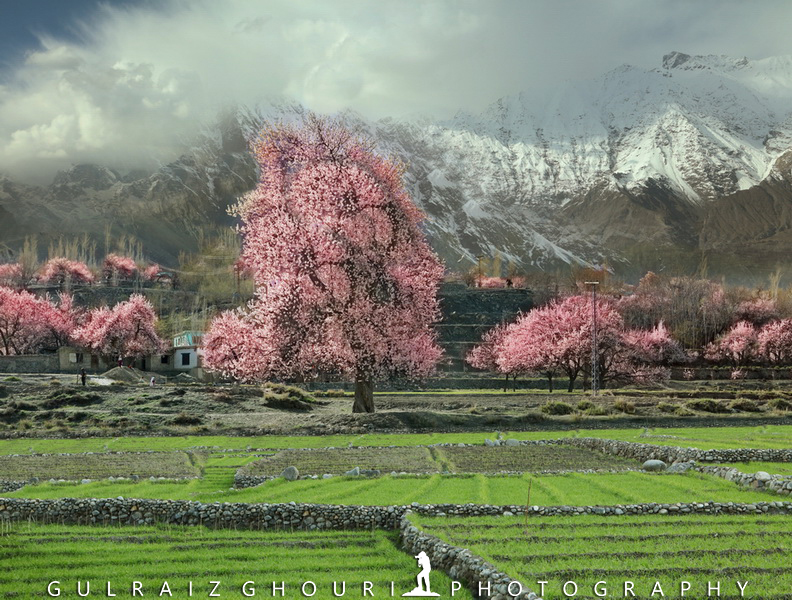
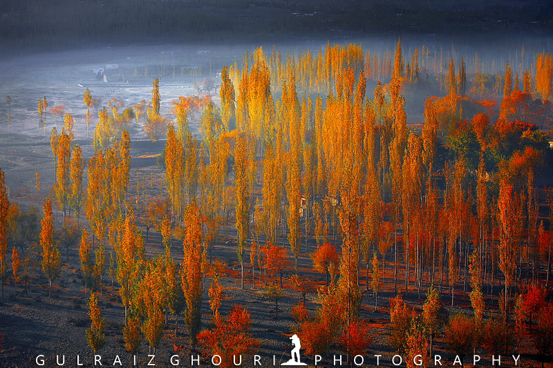
Spring starts with blooming trees and flowers, making it an extraordinary view as well as all the other times to visit the lovely valley, slope stations, and lakes. People usually indulge in climbing, mountain biking, swimming in summer. Falling of leaves from trees is witnessed during harvest time in the lush green conifers. Winter season encourages activities such as snowboarding or skiing. Thus, for each season in Gilgit Baltistan, there is bounty to see, parts to do, and everything to appreciate.
History:
The history dates back to rock inscriptions found in areas of Chilas, Hunza, Gilgit, Skardu, Khaplu, and Shigar. Furthermore, it is credited to be part of the Tibetan dynasty during the 7th century. However, thanks to the Gilgit scouts, it was liberated in 1947. Initially, Gilgit was a separate Islamic state, but fifteen days of the liberation, it was taken over by Pakistan. Gilgit was named during the Bhutto rule as the region in Northern Areas of Pakistan.
Geography:
Gilgit-Baltistan fringes Pakistan's Khyber Pakhtunkhwa region toward the west, slightly to Wakhan Corridor of Afghanistan extended towards northern China's Xinjiang Uyghur region. Further towards the upper east, the Indian-managed Jammu and Kashmir and the southeastern part, and lastly province of Azad Jammu Kashmir towards the south.
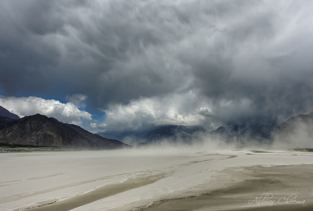
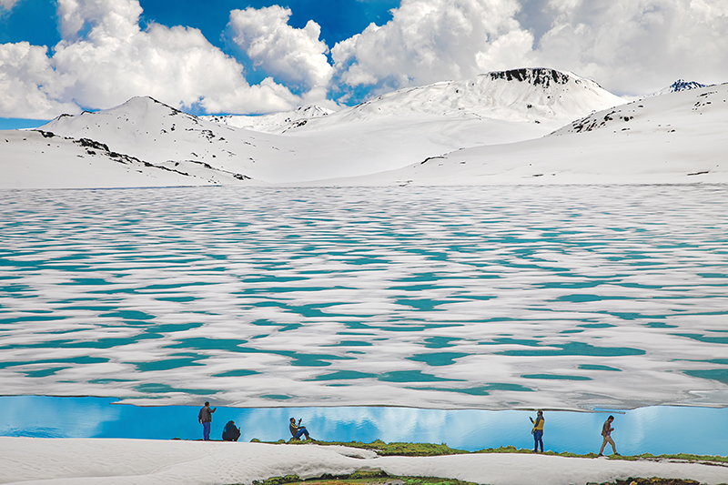
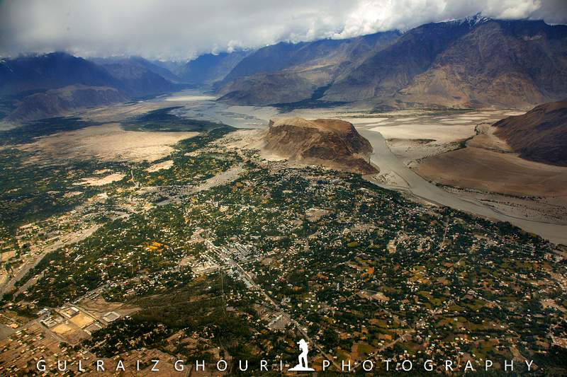
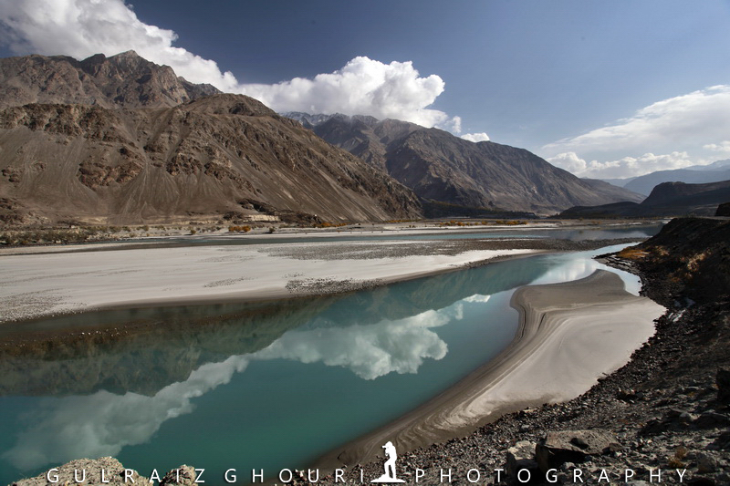
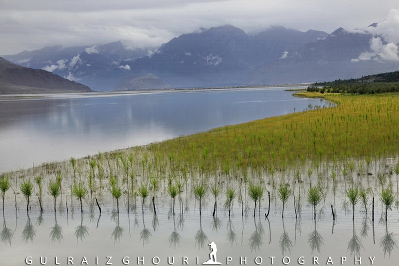
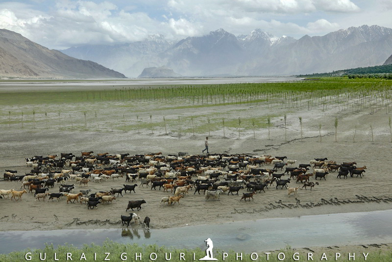
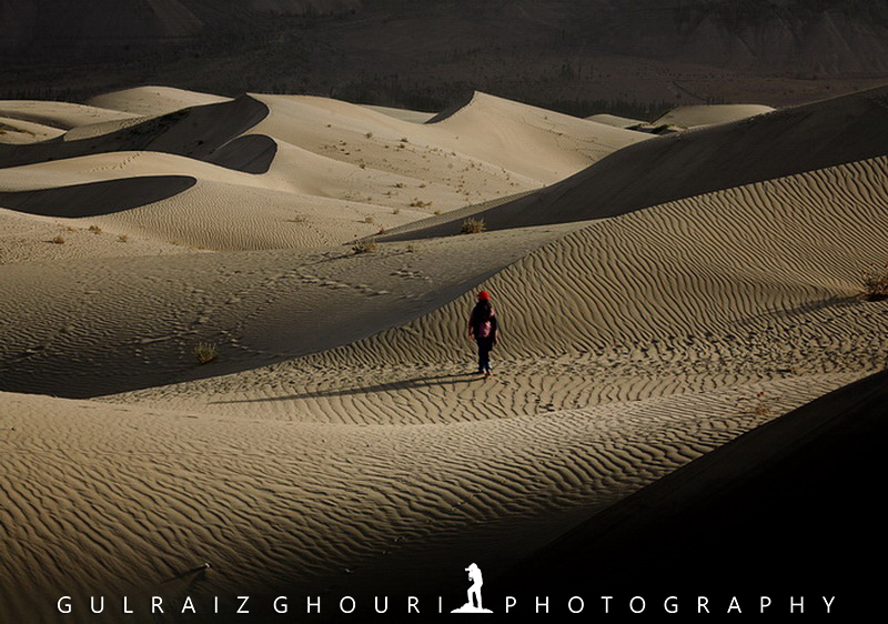
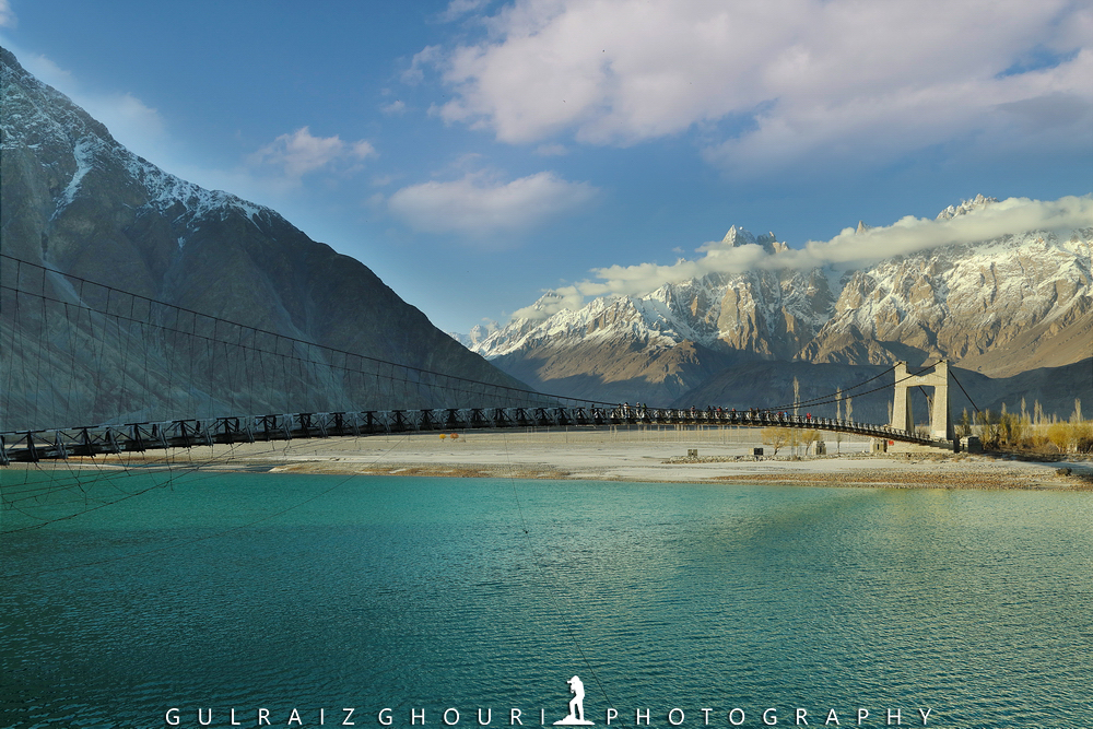
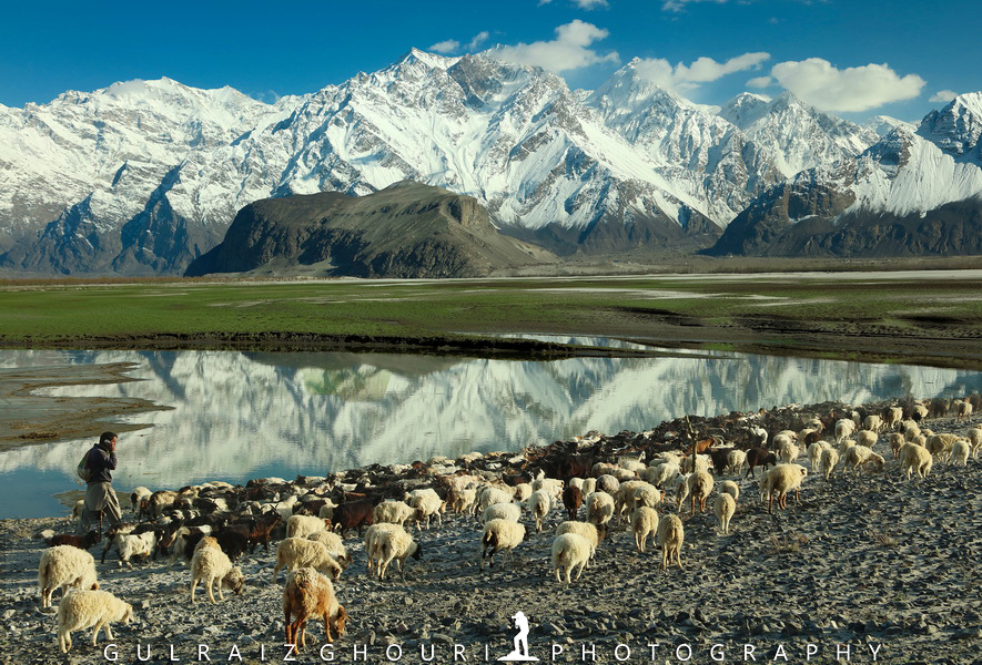
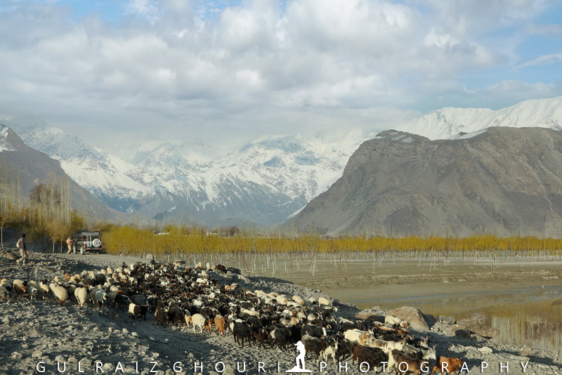
Gilgit-Baltistan is home to every one of the five of Pakistan's eight-thousands and over fifty tops over 7,000 meters. Gilgit and Skardu are the two major centres for endeavours to those mountains. The district is home to a portion of the world's most astounding mountain ranges. The primary extents are the Karakoram and the Western Himalayas. The Pamir Mountains are towards the north, and the Hindu Kush deceives the west. Among the most noteworthy mountains are K2 and Nanga Parbat, the last being one of the most dreaded mountains on the planet. Three of the world's most extended icy masses outside the polar districts are found in Gilgit-Baltistan, namely the Biafo Glacier, the Baltoro Glacier, and the Batura Glacier. There are, likewise, a few lakes in Gilgit-Baltistan with high elevation. The Deosai Plains are situated over the tree line and comprise the second-most exceptional level on the planet at 4,115 meters after Tibet. The plain is located towards East of Astore, South of Skardu, and West of Ladakh. Deosai Plains spread about 5,000 square kilometres. During September to May, Deosai is bound by snow and tends to cut off from rest of Astore and Baltistan in winters, situated near the vicinity of Chillum Chokki.
Climate:
The Climate of Gilgit differs locale wise; encompassing mountain extents makes sharp varieties in the environment. The eastern part has the soggy zone of the Western Himalayas, yet going towards the Karakoram and the Hindu Kush the atmosphere dries impressively. Gilgit is sweltering during the day time in summer, however cold during the evening. Such climate is experienced in valleys such as Astore, Khalpu, Yasin, Hunza and Nagar with cold temperatures notwithstanding throughout the late spring.
With the altitude of 1,500 meters, Gilgit experiences a desert atmosphere with warm summers and cold winters. Throughout the late spring temperatures, over 30 0 C are phenomenal. Winters are cold longer periods with below zero temperatures reasonable. Precipitation figures are low lasting throughout the year. Throughout the winter, precipitation regularly falls as a day of hail.
Places:
Ghanche:
Ghanche District is the easternmost locale of Gilgit–Baltistan, Pakistan. With its capital in the noteworthy city of Khaplu, Ghanche is acclaimed as a visitor goal for its extraordinary view and high elevation scenes. To its upper east is Xinjiang (China), toward the north and northwest is Skardu District, to its southwest is Kharmang District and to its south is Ladakh of Indian managed Jammu and Kashmir. This district is the coldest spot inside Pakistan, likewise called the "Third Pole" with temperatures coming to underneath - 20 °C in the winter.
Khaplu Valley and Hushe Valley structure the portal for the incomparable Baltoro Muztagh, the subrange of Karakoram that incorporates the compelling pinnacles of K2 (8,611 m), Broad Peak (8,047 m), Gasherbrum (8,000+ m) and Masherbrum (7,821 m) which are all incorporated into the Skardu District. Locals of the Khaplu Valley privately utilize it for Ghanche Nallah (a Seasonal Stream), which streams in the middle of the Khaplu town during the summer season.
Shigar:
Shigar District is an authoritative sub-division of Gilgit-Baltistan, a piece of Baltistan, and right now establishes one of the ten areas of the Gilgit–Baltistan region of Pakistan. It is limited on the south and southwest by Skardu area, on the east by Ghanche District, on the north by Xinjiang (China), on the northwest by and Hunza, Nagar, Gilgit Districts. The region was framed in 2015, preceding which it was a piece of the Skardu District. Shigar town is the capital of the Shigar District. Shigar town is 30km away from Skardu city. Shigar is the home of the world's second-most elevated pinnacle K-2.
Kharmang:
Kharmang District is a political subdivision of Pakistan. It is a piece of Baltistan and as of now, establishes one of the ten areas of the Gilgit–Baltistan region of Pakistan. It is restricted to the south by Kargil region of the Jammu and Kashmir, on the upper east by Ghanche District of GB, on the north by Skardu District of GB and the west by Astore District of GB. Kharmang locale incorporates Kharmang Valley, one of the five major valleys in the Baltistan area.
Gilgit:
Gilgit District is one of the areas of the Gilgit–Baltistan domain in northern Pakistan. It was shaped in 1970 when the government controls Gilgit-Baltistan as the "Northern Areas", limited by the Wakhan Corridor (Afghanistan) toward the north; Xinjiang (China) toward the upper east and east; Skardu, Astore, and Diamer toward the south; and Ghizer District toward the west. The town of Gilgit is the capital of Gilgit District. As indicated by the 1998 enumeration, Gilgit District had a populace of 243,324. The locale incorporates Gilgit (the capital city), the Bagrot Valley, Juglot, Danyore, Naltar Peak, and the Normal Valley. The most noteworthy top in the locale is Distaghil Sar 7,885 meters (25,869 ft), which is the seventh-most remarkable top in Pakistan and nineteenth most noteworthy on earth. Just a piece of the bowl of the Gilgit River, for example, Gilgit Valley, is incorporated inside the political limits of Gilgit District.
Ghizer:
Ghizer District is the westernmost bit of the Gilgit-Baltistan region of Pakistan with the capital, Gahkuch. Ghizer is an intersection among Gilgit and Chitral by methods for Shandur Pass, and to China and Tajikistan by plans for the Broghil Pass-through Ishkomen Valley. Ghizer is a multi-ethnic region, where they speak three significant dialects; Shina, Khowar, and Burushaski. There are likewise Wakhi speakers in Ishkomen and a few Tajiks. The word Ghizer originated from the name "Gherz" which signifies "displaced people" in Khowar. "Ghzier" is a town in Golaghmuli Valley, which is presently known as Golaghmuli. Indeed, two primary attributes of the cultural dress of Ghizer are the Khoi and the Shoah. The Khoi is headgear made of natively constructed woollen fabrics, while the shokah is a custom-made woollen shroud coming to the lower leg with long sleeves.
Hunza:
Hunza District is one of the areas of the Gilgit-Baltistan domain in northern Pakistan, built up in 2015 by the division of Hunza–Nagar District in an offer to build up progressively authoritative units in the locale. Karimabad is the managerial focal point of the area. The Hunza locale speaks to the northernmost district of the Indian subcontinent, abutting China's Xinjiang region. It contains the memorable goes through the Karakoram mountains (Killik, Mintaka, Khunjerab and Shimshal goes) through which exchange and religion went among India and Central Asia/China for quite a long time. The present-day, Karakoram Highway goes through the Khunjerab Pass to enter Xinjiang.
Nagar:
Nagar is a region situated in Gilgit-Baltistan, which is the northernmost self-governing domain in Pakistan. It was set up in 2015 by the division of Hunza–Nagar District in an offer to set up increasingly administrative units in the area.
Diamer:
Diamer District or Diamer locale is one of the areas in the Gilgit-Baltistan territory of Pakistan. It is the zone through which the Karakoram Highway passes. The capital of the district is Chilas. Diamer District is restricted by Astore District in the east, by the Khyber Pakhtunkhwa in the southwest (secluded by the Babusar Pass or Babusar Top), Neelum District in the south, the Ghizer District in the north and northwest, and the Gilgit District in the north and upper east. Before the Karakoram Highway opened in 1978, the central avenue coming to Gilgit town from the south was a brutal track north from Balakot to Babusar Pass (by methods for Kaghan, Naran, Besal, and Gittidas) and further north through Babusar Gah to Chilas. The road up to Besal is by and by in better condition, from Besal to Babusar Pass, the path is incredible with the new covered highway.
Astore:
Astore is one of the ten districts of Gilgit-Baltistan, Pakistan. The zone contains the Astore Valley (with the town of Astore). It is constrained toward the west by Diamer District (from which it disengaged in 2004), at the north by Gilgit District, close to the east by Skardu District and toward the south by Khyber-Pakhtunkhwa and Neelum District of Azad Kashmir.
As per the 1998 evaluation of Pakistan, the populace was 71,666. The Astore valley has a territory of 5,092 km and a height of 2,600 meters (8,500 ft). The valley has a roughly 250 square kilometres (97 sq. mi) of ice sheet spread. The closest icy mass after entering the valley is Harcho and the most active open polar mass in Siachen.
People:
Roughly 14% of the populace is urban, while the evaluated populace of Gilgit-Baltistan is more than 2 million. The number of inhabitants in Gilgit-Baltistan comprises of numerous differing semantic, ethnic, and religious organizations, due to a limited extent to the many disconnected valleys isolated by an area of the world's most noteworthy mountains. The ethnic gatherings incorporate Shins, Yashkuns, Kashmiris, Kashgaris, Pamiris, Pathans, and Kohistanis. A critical number of individuals from Gilgit-Baltistan are dwelling in different pieces of Pakistan, fundamentally in Punjab and Karachi. The education pace of Gilgit-Baltistan is roughly 72%. Gilgit-Baltistan is a multilingual district where Urdu being a national and authority language fills in as the most widely used language for bury ethnic interchanges. English is co-authority and utilized in training, while Arabic used for religious purposes.
Gilgit is known to be home for many individuals having a place in various locales, just as from different urban areas of Pakistan. Being the base camp of the Gilgit-Baltistan, nearly of the vital workplaces situated in Gilgit. A more significant part of the occupants are Muslim having a place with two distinct networks of elucidations, for example, Sunnis, Shias, and Ismailis. Few Christians additionally dwell in Gilgit. People of Gilgit are known to be rather fond of music and dances. The instruments generally utilized in Gilgit-Baltistan are Dadang (drum), Damal and Surnai while some different musical instruments like Sitar, Gabi (Flute) Rabab, and Duff speak to the various territories. Next to this Khiling-boo-chang, Porgho-too and so forth tools are utilized in Baltistan district. The well-known trio band music is played in this locale, as in a large portion of different zones. On the musicality of this noisy music, people love to dance in their typical way. There are a few varieties in verses in different districts. The individuals of Gilgit have one of a kind and excellent moves in various parts.
Hotels:
There are various sorts and range from luxurious lodgings and boutique hotels to spending motels. All the hotels give bewildering settlement to their guests autonomous of whether they are excess or spending lodgings. The value reaches are from ordinary to high, contingent upon the administrations you benefit.
Restaurants:
Giving a full extent of diners, Gilgit Baltistan is acknowledged to have a superb and novel inclination for the desi/neighbourhood food, which for without question means the vacationer's vitality.
Shopping:
Gilgit is home to many shops and bazaars where locals and tourists can purchase fabric, traditional clothes, handicrafts, dry fruits, and general grocery items with much ease.
Health:
There are both private and public segment emergency clinics winning in the district to take care of the therapeutic needs of the local people and visitors.
Security:
If there should be an occurrence of crisis, dial 1122 to benefit prompt salvage.
Transport:
Transport administrations, for example, Careem and Uber are sadly not accessible in the territory. However, neighbourhood taxicabs, carriers, and four-wheel-drive vehicles are bounteously convenient to travel and move around quickly.
Important Numbers:
Tourist Assistance Helpline at Central Police Office: 0581115/05811930345
Tourist Assistance Helpline of District Police Gilgit: 05811930033
Tourist Assistance Helpline of District Hunza-Nagar: 0581315/ 05813930722
Tourist Assistance Helpline of District Diamer: 05812930037
Tourist Assistance Helpline of District Skardu:05815930132
Tourist Assistance Helpline of District Astore: 05817930420
Tourist Assistance Helpline of District Ghanche:05816930171